ICESat-2: Five facts about Nasa's new space laser
- Select a language for the TTS:
- UK English Female
- UK English Male
- US English Female
- US English Male
- Australian Female
- Australian Male
- Language selected: (auto detect) - EN
Play all audios:

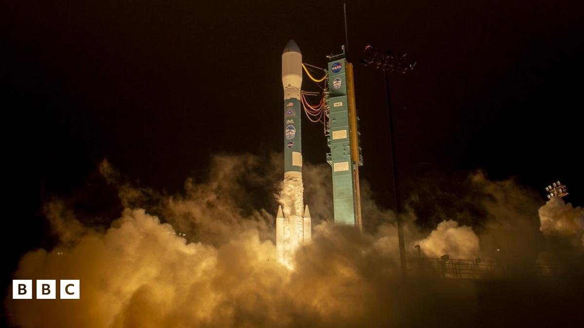
ICESat-2: Five facts about Nasa's new space laserPublished16 September 2018comments2 CommentsImage source, Bill Ingalls/NASA And lift off... of Nasa's ICESat-2. Mission: to measure how the
frozen regions of our planet are affected by global warming.
The American space agency's new satellite blasted off aboard a Delta II rocket from an air force base in California, USA, on Saturday.
It is hoped that ICESat-2 will help produce the first truly detailed maps of sea-ice thickness in the Antarctic.
So let's find out a bit more about it!
Need more space stories? Quiz: Nasa - True or false?
The Mars mission going where no mission has gone before
Nasa's planet-hunter launches into space
1. As heavy as a polar bear Considering ICESat-2 will be monitoring the icy regions of the north pole as well as the Antarctic, that's a pretty appropriate comparison!
The satellite weighs about 500kg which is half a tonne.
The system is one of the largest Earth-observation instruments ever built by Nasa.
Image source, NASAImage caption, ICESat-2 in orbit around the earth
2. 10,000 shots a second Once in orbit around the earth, the laser will fire 10,000 shots of light per second! It's a technique called photon counting. A 'photon' is a particle of light.
Each shot fired by the laser hits the earth's surface and bounces back. The time it takes for the light to bounce back to the satellite helps scientists work out distance and height of the
reflecting surface.
Cathy Richardson, who has helped develop the instrument explains:
"We fire about a trillion photons in every shot. We get about one back... We can time that one photon when it comes back just as accurately as when it left the instrument. And from that we
can calculate a distance to about half a centimetre on the Earth."
3. 500km above Earth ICESat-2 will measure every 70cm as it moves across the ice surface.
It's laser beams are split into three pairs, six lasers in total, scanning and mapping more of the ice for depth changes than ever before.
All at a height of 500 kilometres (just over 300 miles) above us!
Image source, NASAImage caption, The £765million mission is funded for three years
4. It's not the first time... ICESat-2 is the giveaway. As its name would suggest, this isn't the first time Nasa has used an instrument to complete such a mission.
The original spacecraft orbited the earth in 2003, launched from the very same air force base as this one.
It operated for seven years before technical problems caused it to shut down, and scientists were unable to restart it.
It's hoped the new technology will be more reliable and give better, more frequent updates, giving Nasa better snapshots of the ice.
Image source, NASAImage caption, Artwork: You might be able to see ICESat-2 from space
5. Can you see it from space? If you're really lucky, on a clear, dark night you might just spot the green light of ICESat-2 in orbit, busy working away on its mission to find out how the
world's ice is changing.
It will appear as a small, green dot, so keep your eyes peeled.
More on this story Quiz: Nasa - True or false?
Published28 September 2018 Touchdown triumph for Nasa's Mars robot
Published27 November 2018 Nasa's planet-hunter launches into space
Published19 April 2018