Weekend of storms before temperatures plunge in France
- Select a language for the TTS:
- UK English Female
- UK English Male
- US English Female
- US English Male
- Australian Female
- Australian Male
- Language selected: (auto detect) - EN
Play all audios:

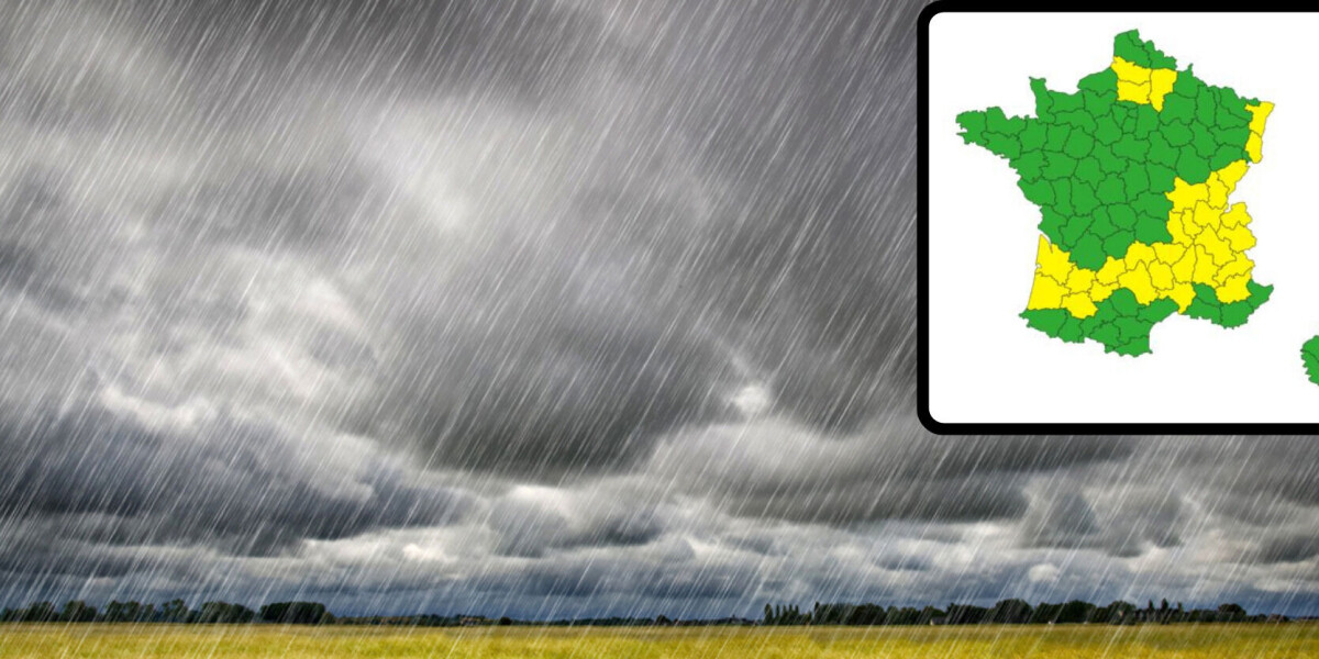
A third of France has been placed on alert for storms or flooding today (June 7). It comes as the French weather service forecasts the return of autumnal weather from next week due to the
arrival of cool and wet air from the British isles.
The sunshine of the first week of June, which much of France experienced, will give way to unsettled weather as storms arrive over much of central France today.
Méteo France has placed 28 departments on alert, most of which are due to storms. There is also a risk of flooding in four departments in the north.
The ‘yellow alert’ level - the lowest in the weather service’s three tier system - is used to advise the public to display caution and not take unnecessary risks due to developing weather
events.
Sand from the Sahara is expected to return to the south of France on Friday, before the African air is displaced.
The fine Saharan sand, which is carried across the Mediterranean, can give the sky an orange hue, and falls over France in the wind and rain.
Read more: Saharan sand in wind turns skies orange in south-west France
While the particles are not considered dangerous, they can contribute to respiratory problems in susceptible individuals
The stormy weather will move south over the weekend, striking the Mediterranean coast on Sunday, June 9.
The temperatures will continue to fall on June 10, with rain and cloud covering all of France by June 11.
The wet weather is expected to persist over France for much of June.
Read more: Mysterious aquatic phenomenon in Dordogne river re-emerges after rainiest May since 1981